High Resolution
Airborne Magnetometer Surveys
High resolution airborne magnetometer surveys can play an
important part in your exploration program. Improvements
in magnetometer design have resulted in more accurate
data, which combined with GPS, yield significantly better
aeromagnetic maps. The overall improvement in accuracy
often warrants resurveying areas which were flown using
instrumentation and methods now considered obsolete.
High resolution aeromagnetic maps reflect the underlying
geology regardless of the degree of exposure. They play
such an important role in interpreting structures and rock
type distribution that high resolution magnetometer
surveying can truly be called a basic, universal
exploration tool. Moreover with the relatively low cost of
aerial magnetometer surveys they are particularly
attractive in the early stage of an exploration project,
when large areas need to be covered rapidly.
Airborne Magnetometer Surveys at SGL
Sander Geophysics Limited (SGL) of Ottawa, Canada,
specializes in flying high resolution magnetometer surveys
worldwide. To maintain our position as a leader in the
field, SGL's engineers and scientists are actively
involved in developing better instruments and survey
methods.
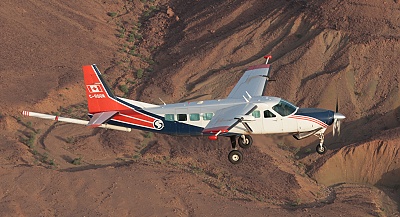
One of SGL's Cessna Grand
Caravans
We use optically pumped cesium magnetometers with a
sensitivity of 0.005 nT, and computer controlled real-time
digital compensation, giving an overall system resolution
of 0.01 nT. The magnetometer sensors in the aircraft and
in the reference station are identical, ensuring that all
magnetometer data sets are equivalent in terms of
sensitivity and noise envelope. The sampling rate can be
adjusted depending on survey requirements, with most
surveys delivered at 10 Hz.
Fixed Wing Magnetometer Surveys
All of our aircraft have been extensively modified to
accommodate geophysical instruments and to reduce the
aircraft's magnetic field. Typical Figures of Merit (FOM)
for SGL's fixed wing aircraft are less than 1 nT. Our
standard configuration is to have a single magnetometer
sensor mounted in a "stinger" rigidly attached to the tail
of the aircraft. Alternatively, several magnetic sensors
can be used simultaneously to directly measure the
horizontal and/or vertical gradient of the magnetic field
by separating the sensors horizontally on booms attached
to each wing of the aircraft, and separated vertically on
the tail stinger.
Helicopter Magnetometer Surveys
Magnetic data can be acquired using a “bird” towed
beneath the helicopter, which incorporates two total field
magnetic sensors that are separated horizontally. The bird
maintains a constant separation of 4.9 m between the
magnetic sensors, which allows recording of the measured
horizontal gradient. A GNSS (dual frequency GPS) antenna
mounted directly on the bird provides accurate sensor
position data.
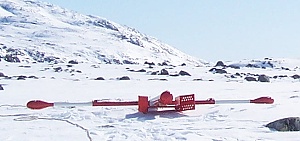
SGL "bird" in Greenland
Alternatively, a single total field magnetometer can be
mounted in a stinger rigidly attached to the front of the
helicopter, eliminating the need for the towed bird. This
option can be useful in built-up areas where towed loads
may not be permitted. If there is no regulatory
restriction, we usually prefer to use a towed bird because
it is magnetically quieter and yields higher quality data.
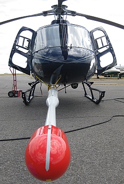
C-FXPL with stinger
Navigation, Data Recording and Processing
SGL’s aircraft are equipped with GNSS receivers (dual
frequency GPS) integrated into a proprietary navigation
and flight path recovery system. This system, called SGNav,
allows for excellent navigation and provides an accuracy
of better than 1 m in post-flight recovery. SGNav
is used in conjunction with our pre-planned,
computer-aided drape flying system, SGDrape.
This system allows us to produce a drape flying surface
which is optimal for safety and data quality. Using a
drape surface ensures that adjacent flight lines and
control lines are flown at comparable levels, resulting in
better quality magnetic data.
SGL’s reference stations automatically record diurnal
fluctuations of the earth's magnetic field. Both airborne
and ground magnetometer data acquisition computers use a
temperature compensated quartz crystal oscillator and a
counting circuitto provide real-time clocks. These clocks
are synchronized to the GPS time strobe, which has an
absolute accuracy of 0.5 x 10⁻⁶.
The company’s data centre in Ottawa is equipped for
processing and interpretation of high resolution magnetic
data. An array of products designed to represent the
geology, as expressed through the magnetic data is
available. SGL provides complete interpretational services
by experienced geoscientists, enhancing the value of your
high resolution airborne magnetic survey.
Airborne Magnetometer Survey System
| Airborne Instruments |
| Magnetometer Sensor |
Geometrics |
| Strap-down, optically pumped, cesium
split beam |
| Sensitivity: 0.005 nT |
| Sensor noise level: <0.02 nT |
| Sampling rate: 10 Hz |
| Compensator |
Sander Geophysics - AIRComp
real-time digital compensation |
| Range: 20,000 to 200,000 nT |
| Resolution: 0.001 nT |
| Sampling rate: 160 Hz |
| Data Acquisition System |
Sander Geophysics - SGDAS
airborne computer |
| Capable of recording unlimited number
of channels at variable intervals, and digital
scrolling chart display of the data. Data is
recorded on a vibration tolerant removable drive.
The system clock is a quartz time standard
automatically synchronized to UTC by the GPS signal
to an accuracy of 1 millisecond. |
| Video Imaging System |
Sander Geophysics - SGDIS
digital video |
| Radar Altimeter |
|
Resolution (m) |
Calibrated to |
Range
(m) |
| TRT AHV8 |
0.5 |
1% |
0 to 3,050 (10,000 ft) |
| King KRA-10 |
0.1 |
1% |
0 to 760 (2,500 ft) |
| FreeFlight |
0.5 |
1% |
0 to 760 (2,500 ft) |
| Barometric Altimeter |
Sander Geophysics Digitally Recording
Barometric Altimeter |
2.0 |
±4 m |
0 to 10,000 (33,000 ft) |
| Reference Station Instruments |
| Magnetometer Sensor |
Same as airborne |
| Magnetometer Interface |
Sander Geophysics - SGRef |
| Range: 20,000 to 100,000 nT |
| Resolution: 0.01 nT |
| Sampling rate: 2 Hz |
| Data Acquisition System |
Sander Geophysics - SGRef |
| This system runs SGL data acquisition
software capable of recording an unlimited number of
channels at variable intervals, and includes a
digital scrolling chart display of the data. Data
is recorded on a vibration tolerant removable drive.
The system clock is a quartz time standard
automatically synchronized to UTC by the GPS signal
to an accuracy of 1 millisecond. |
| Power Source |
12 VDC can be wind or solar powered |
| Navigation Instruments |
| Global Positioning System |
NovAtel - GNSS (Global
Navigation Satellite System), reference and airborne |
| Sampling rate: 20 Hz |
| Real-Time Differential GPS |
Satellite link to the aircraft for
real-time in-flight differential GPS (RDGPS), if
required |
|